Public Transit in America’s Biggest Cities: Apps, Passes, and Local Tips
By Jeff Lowe • November 11, 2025
If you’re exploring America’s biggest cities, learning to navigate their public transit systems can make or break your trip.
From the dizzying subway maps of New York to the breezy light rail of Los Angeles, each city has its own rhythm, rules, and tricks for getting around efficiently.
Whether you’re a first-time visitor or just someone who prefers skipping rental cars and parking headaches, this guide will help you move like a local—using apps, understanding fare systems, and knowing a few unwritten etiquette rules that go a long way.
So, let’s dive in and decode America’s urban transit maze—because once you figure it out, you’ll realize it’s not so intimidating after all.
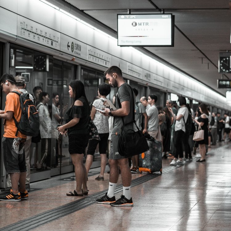
Getting to Know the Big City Transit Networks
Every major U.S. city has its own public transit personality. Some are sleek and tech-forward; others are old-school but reliable once you get the hang of them.
-
New York City: The MTA is your lifeline. Subways run 24/7 (a rarity in the U.S.), and MetroCards are being phased out in favor of OMNY—just tap your credit card or phone at the turnstile.
-
Chicago: The “L” (short for “elevated”) is run by the CTA. You can ride it to almost any neighborhood or even out to the airports.
-
Washington, D.C.: The Metro is clean and efficient, but fare prices vary by distance, so check your total before you tap.
-
San Francisco: Between BART, Muni, and Caltrain, you’ll need to know which line serves your destination. Clipper cards or mobile payments cover most systems.
-
Los Angeles: Once known for its car obsession, L.A. now has an expanding Metro rail and bus network—plus tap-enabled fare cards and bike-share options.
Knowing the local system helps you plan transfers, estimate costs, and avoid the “which train goes where?” moment that every first-timer faces at least once.
The Best Transit Apps You’ll Actually Use
Gone are the days of unfolding giant paper maps or trying to interpret faded bus schedules at 11 p.m. A few handy apps can turn you into a public transit pro instantly.
-
Citymapper: A traveler’s dream—it combines subway, bus, rideshare, and walking directions in one place. It’s great for real-time delays and alternate routes.
-
Transit App: Especially popular in the U.S., this one’s clean, accurate, and syncs with most city systems. You can even buy tickets directly in some cities.
-
Google Maps: Still one of the easiest for quick navigation. Just switch to the “transit” option, and you’ll get train times, walking directions, and delays.
-
Moovit: Great for both domestic and international travelers. It tells you which train car to board, what exit to take, and sends alerts for when to get off.
Tip: Before you land, download the transit app specific to your destination city. Many U.S. cities—like Boston’s MBTA or Seattle’s Sound Transit—offer official apps that let you purchase passes, check live arrivals, and track buses.
Fare Cards and Passes: What You Need to Know
If you’re staying for a few days, figuring out the best fare option can save both time and money.
-
Single Ride Tickets: Best for short visits or one-off rides, though they can add up quickly.
-
Day Passes: Ideal if you plan to hop around a city all day—common in cities like Chicago and San Diego.
-
Weekly or Monthly Passes: Great for longer stays or business trips, where unlimited rides often pay for themselves after a few days.
-
Tap-and-Go Payments: Many cities now let you use contactless credit cards, Apple Pay, or Google Wallet directly on fare gates—no pass required.
In New York, the OMNY system automatically caps your fare once you’ve spent enough in a week—essentially turning your pay-per-ride into an unlimited pass. Chicago and D.C. have similar options. Always check whether your city offers these “fare capping” systems; they’re perfect for spontaneous travelers.
Timing Is Everything
When it comes to transit, timing can make all the difference between a breezy ride and a stressful one.
-
Rush Hour: Generally 7–9 a.m. and 4–6:30 p.m. Expect packed cars, limited seating, and slower service.
-
Late Nights: Some systems, like New York’s, run 24/7—but service may be less frequent. Others, like D.C.’s Metro, close before midnight.
-
Weekend Schedules: Trains and buses often run less frequently or have planned maintenance. Always check weekend timetables.
Pro tip: If you’re catching an airport connection via public transit (like BART to SFO or the “L” to O’Hare), leave a buffer—delays happen, especially during maintenance or weather disruptions.
Local Etiquette: The Unwritten Rules
Each city has its own social rhythm, but a few universal etiquette rules apply wherever you ride.
-
Let Riders Exit First: Always let people off before boarding—it’s basic flow logic.
-
Keep Right on Escalators: Especially in D.C. and New York. Stand on the right, walk on the left. Break this rule, and you’ll hear about it.
-
Don’t Block Doors: Move into the center of the car so others can board.
-
Keep Conversations (and Music) Down: Loud calls or music without headphones are big no-nos.
-
Offer Seats When Needed: Pregnant passengers, older adults, and people with disabilities always get priority seating.
-
No Eating (Sometimes): Some cities, like D.C., prohibit eating or drinking in trains—check signs before snacking.
Small gestures go a long way. Locals appreciate travelers who respect these norms—it shows you’re paying attention.
City-Specific Hacks and Hidden Perks
Every city’s system has quirks, shortcuts, and perks that only regulars tend to know about. Here are a few to keep in your back pocket:
-
New York City: The MTA Live Subway Map online shows real-time train movement—it’s mesmerizing and genuinely useful.
-
Chicago: You can use your Ventra card for Divvy bikes and even at select retail stores.
-
Los Angeles: Download the TAP app to manage Metro cards, load funds instantly, and see bus arrival times.
-
Boston: The CharlieCard (named after the famous “M.T.A.” song) offers discounted fares versus paying cash.
-
Seattle: The ORCA card works on almost every mode of transport—buses, ferries, light rail, even the monorail.
Little things like these make local travel smoother—and sometimes, they even save you a few dollars.
Accessibility and Safety
America’s biggest cities have made major strides in accessibility, but the ease of use varies. Elevators aren’t always available at every station, especially in older systems like New York’s. Check the transit website or app for accessible route planners.
Safety-wise, most systems are well-patrolled and monitored, but common sense goes a long way. Keep belongings close, avoid empty cars late at night, and stand near other passengers when possible. Many cities have emergency call buttons or text-a-tip services if something feels off.
Eco-Friendly Transit: Good for You and the Planet
Using public transit doesn’t just save money—it’s one of the most sustainable ways to travel. Cities like San Francisco and Seattle power much of their fleets with renewable energy, while L.A. is rolling out electric buses across the county.
Even short-term visitors can make an impact by opting for transit over rideshares. If you’re combining walking, biking, and buses, you’re already reducing emissions and traffic congestion. That’s a win for everyone.
When Transit Meets Travel Adventure
For many travelers, mastering a city’s transit system becomes part of the adventure. Think about it—riding a packed subway in Manhattan, a scenic trolley in San Francisco, or a ferry across Puget Sound in Seattle can all be part of the story you tell later.
It’s not just about getting from point A to point B. It’s about feeling the pulse of the city, seeing local life up close, and maybe discovering a new favorite coffee shop at a stop you hadn’t planned to take.
Finding Your Urban Groove
Public transit in America’s biggest cities might look intimidating at first, but once you’ve cracked the code, it becomes second nature. With the right apps, a good understanding of passes, and a bit of city etiquette, you’ll find it’s one of the most efficient, affordable, and authentic ways to explore urban America.
So next time you’re in town, skip the rideshare queue, grab a tap card, and hop on the local line. You might just find that the best way to see a city is from the seat of a subway car—or the window of a late-night bus.